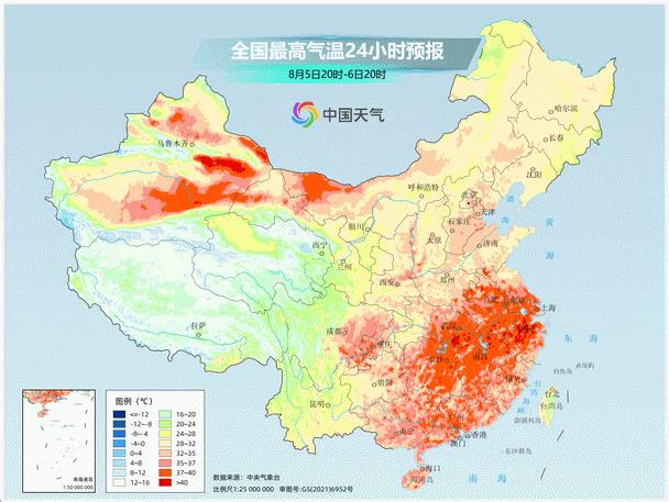
The high temperature map will be extended to Guangdong, Jiangsu, Zhejiang and Shanghai, and the surface temperature will exceed 60℃
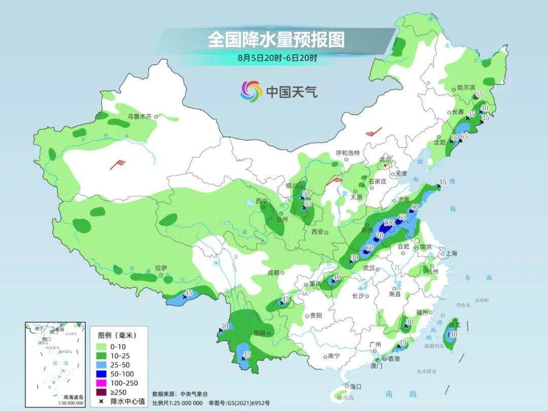
Since the end of July, high temperature has been expanding its territory. On July 31st, it only occupied Shandong, Jiangsu, Zhejiang, Shanghai, Anhui, Hubei and other places. On August 4th, it has occupied a large area from Shandong, eastern and southern Henan to Guangdong and Hainan, affecting more than 10 provinces.
During the period, there are still many places that are hot enough to break records! For example, on the 4th, 10 national weather stations broke the record of the highest temperature in August, among which Longquan, Quzhou, Jiangshan and Jiangdu in Zhejiang broke the record of local observation history.
Such hot weather has made many netizens ridicule that "it takes courage to go out" and "going out is a free sauna" …
In the hottest time in the afternoon, the weather in some places will suddenly "change face", with dark clouds gathering, pouring rain, and possibly strong winds and hail, which is what netizens jokingly call "boiling water." What the hell is going on here?
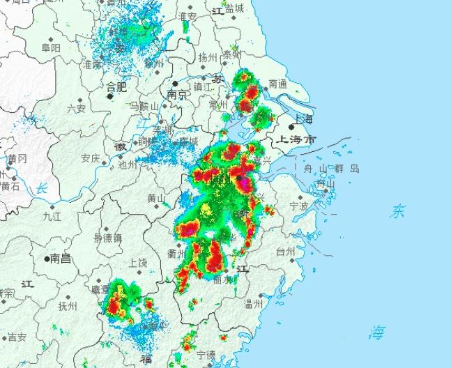
Yesterday afternoon, strong convective weather suddenly appeared in the high temperature core area of 40℃.
In fact, this is a thermal convection phenomenon. Tang Xiaojing, a meteorologist of China Weather Network, said that in summer, sunny and hot weather and thunderstorms often appear one after another. This is because the high temperature in summer makes atmospheric energy accumulate continuously, and sufficient unstable energy turns the atmosphere into a "powder keg" that may explode at any time. Once it encounters cold air, it is easy to be "ignited", so that the accumulated energy in the atmosphere is released in a short time during the day, and intense convective weather appears, and often the higher the temperature during the day, the more intense the convection. But when the energy is released, the strong convective weather will be over, so it will come and go in a hurry.
From one day, the high incidence of strong convective weather is from afternoon to evening, because after solar radiation, the near-surface temperature reaches the highest in the afternoon, and this high unstable energy can last until night. After the unstable air mass is triggered, the accumulated high energy will be released, forming strong convective weather. About 70% hail occurred from 13: 00 pm to 19: 00 pm, with the most from 14: 00 pm to 16: 00 pm; The most active period of short-term heavy precipitation is from 1600 to 1700.
This local thermal convection is one of the characteristics of the recent high temperature weather process. Tomorrow, Jiangsu, Zhejiang and Shanghai will still have to guard against scattered heat convection in the afternoon, and the weather such as strong lightning, short-term heavy rainfall and even small hail will not be ruled out locally.
In addition to local thermal convection, high temperature weather has the following characteristics that need attention.
① Long duration of high temperature.
Southern Jiangsu, southern Anhui, western Shanghai, Zhejiang, central and northern Jiangxi and other places have the longest duration of high temperature, or will last until the 11th.
Moreover, in southern Jiangsu, Shanghai, Zhejiang, southern Anhui and other places, the duration of high temperature in a day will reach about 10 hours, and the local area can even reach 12 to 13 hours, which belongs to "super long standby".
② High temperature strength.
The above-mentioned areas will be the core areas affected by high temperature. The highest temperature in some areas can reach 40℃ to 43℃, and extreme high temperature may still occur locally.
③ High body temperature sensitivity.
At the same time of high temperature, due to high humidity, the somatosensory temperature in some areas may be 5℃ or more higher than the temperature.
④ The surface temperature is high.
After a long exposure to the sun, the surface temperature in Jiangsu, Zhejiang and Shanghai will reach above 60℃, and the risk of puncture will increase.
Why is the surface temperature higher than the air temperature? What is the difference between the two?
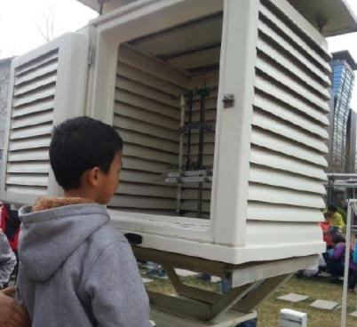
Simply put, the temperature is the air temperature measured in a louver box (below) 1.5-2 meters above the ground, which can represent the basic situation of atmospheric temperature near the ground. The meteorological department generally forecasts the temperature. The surface temperature is the temperature measured on the uncovered soil surface. In the days of summer exposure, the surface temperature will rise rapidly, especially in the afternoon, which is much higher than the air temperature measured by the louver.
Summer is hot, and the hot weather continues. Everyone should continue to pay attention to heatstroke prevention and cooling, reduce the duration of outdoor activities or outdoor work, and beware of heatstroke and heat stroke.